
Navigation Systems Onboard Paikea
Sailing offshore takes more than a phone with a local SIM card and hoping for the best. Out past the range of any cell network, communication and navigation both run through one piece of equipment: an IridiumGo satellite unit and its dedicated aerial, which Shayne built and mounted using a custom fibreglass bracket. Everything — weather routing, email, messaging, family updates, navigation backup — flows through that single link.
How the IridiumGo Actually Works
The physical setup is straightforward once you trace it: the aerial connects via cable running down through a stanchion, into the engine room, along under the bed, under the floor, and finally up into the nav station where it connects to the IridiumGo unit itself. That antenna talks directly to satellites — and worth pausing on just how remote that makes a mid-ocean passage. Partway across the Atlantic, the closest humans aren’t on any nearby vessel or shoreline — they’re the crew of the International Space Station, passing roughly 200 kilometres overhead, genuinely closer at that moment than land itself, still 600 nautical miles away.
Functionally, the IridiumGo behaves like a home WiFi router, except instead of connecting to a landline or fibre connection, it connects to that satellite network instead. Every device on board can log into its WiFi signal just like at home — with one major caveat. Download speeds sit around 12 kilobytes per second, genuinely slower than old dial-up internet (which managed roughly 25kb/s). This is a link built for small, essential data — weather files, short messages, position updates — not browsing or streaming.
Three Devices, Three Jobs
Rather than one device trying to do everything, the system on Paikea splits deliberately across three devices, each suited to a specific role.
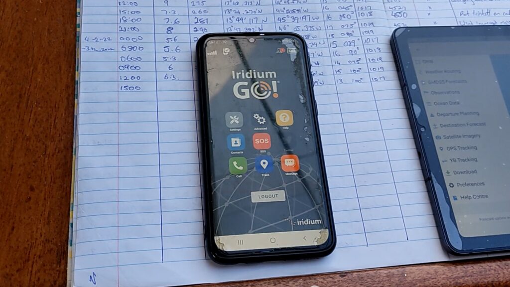
The phone handles basic communication — messaging and calls through the IridiumGo app, plus a genuinely important SOS function built in alongside the usual EPIRB safety gear. A second app, IridiumGo Mail and Web, allows limited email and web access when needed, though given the connection speed, it’s used sparingly and specifically rather than for general browsing. Advantage-wise, the phone is low-power and always on hand — the trade-off is simply screen size, which limits it to backup navigation and weather duties rather than primary use.
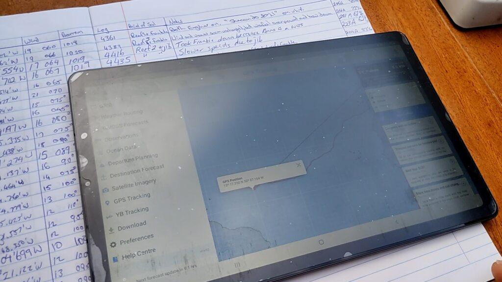
The tablet does the heavy lifting day to day — PredictWind Offshore for weather modelling and routing, Navionics for navigation. It’s genuinely the workhorse of the boat: portable, reasonably capable, and low enough on power draw to run comfortably throughout a passage. The only real downside is losing some functionality compared to the full desktop versions of the same software — and, being portable, it has a habit of going missing somewhere around the boat exactly when it’s needed.
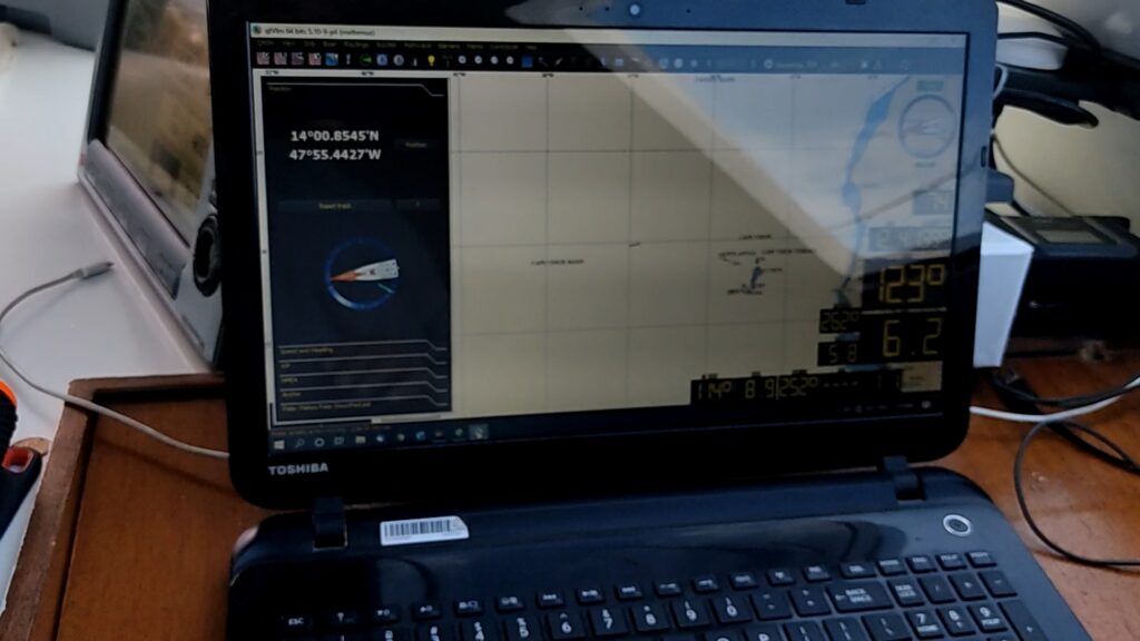
The laptop earns its place for jobs that genuinely need more processing power or screen space — downloading and analysing GRIB weather files through PredictWind, running QtVlm for primary navigation (a system that better matches a racing background and shows considerably more boat performance data than a simple chart plotter), and building custom polar diagrams through OpenCPN, which despite being otherwise a bit clunky to use day-to-day, does this one job — polar generation — better than anything else on board. The laptop’s real weakness is power consumption: big screen, real processing load, genuinely demanding on the boat’s electrical system in a way worth planning around if you’re running a power-conscious setup.
A Raspberry Pi running OpenPlotter serves as a further backup layer beneath all three — including a second Raspberry Pi dedicated specifically to autopilot redundancy, worth its own separate discussion another time.
GPS Tracking and Staying Connected to Shore
Beyond weather and navigation, the same IridiumGo link powers a GPS tracking page that updates every 15 minutes, giving family and friends ashore a live view of the boat’s position along with day-by-day notes on what’s actually happening. It’s a small thing that matters enormously for peace of mind on both ends of a long passage — and it doubles as a genuine record afterward. The exact moment and position where Paikea’s rudder failed mid-Atlantic is marked on that same tracker, timestamped and geolocated precisely, turning what could have been a vague memory into an exact, reviewable data point.
The Logbook: Old-Fashioned and Deliberately So
Every piece of electronic navigation gear on this boat runs alongside something far simpler: a paper logbook, filled in every three hours in sync with the watch schedule, with an alarm set specifically to make sure nobody forgets. It’s not just Shayne’s job — whoever’s on watch at the time writes the entry, kids included, which makes it as much a shared discipline as a record-keeping habit.
The logbook does real, practical work beyond just tradition. Twenty-four-hour run calculations, wind shift patterns, boat speed trends, barometer readings — all the things worth checking against when you’re tired mid-passage and need an honest answer to “how are we actually doing compared to yesterday,” rather than a fuzzy impression. Recent passages have also included detailed battery consumption tracking — autopilot draw, induction cooking load, overnight power use — and a running record of watermaker hours and litres processed, giving a genuine maintenance history rather than guesswork about what’s wearing out and when.
Paper over digital is a deliberate choice, not an oversight. A logbook survives an electrical failure — a lightning strike, a fried instrument panel — in a way no app or tablet ever will, and there’s a real practical value in being able to flip back through pages at a glance rather than navigating a digital interface when you’re exhausted three days into a passage.
More on Paikea’s Systems
Browse through our systems setup at Paikea’s Systems
In the Members Library: the template we actually use for our own logbook — the same format referenced throughout this post — is available to download in the members area.
Download the Paikea Logbook Template →
In This Series
This is part of a longer story — an 11-part account of crossing from the Canary Islands to the Caribbean, including a rudder lost 800 miles from land and the recovery that followed.
Read it in order:
- The Canary Islands: Preparation for Atlantic Passage
- Discovering Chainplate Movement
- Atlantic Crossing on a Modified Catana42: Canary Islands to the Caribbean
- Mid-Atlantic Repairs and Growing Crew
- Downwind Spinnaker Trim
- Daggerboard Control, Watermaker Maintenance & Speed Secrets
- Losing a Rudder 800nm from Land
- How We Sailed 800nm With One Rudder
- We Lost a Rudder in the Middle of the Atlantic
- Navigation Systems Onboard Paikea
- Did Losing a Rudder Damage Our Hulls?